


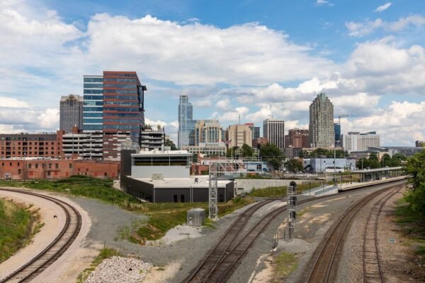
The city of Raleigh, North Carolina is deploying drones and artificial-intelligence (AI)-enabled tools to create a virtual version of itself to meet the urban challenges of today and to help chart the future of the fast-growing metropolis.
Long recognized as the hub of the state’s high-tech Research Triangle region, Raleigh has worked with tech industry partners Esri, NVIDIA and Microsoft to create a digital twin of the city, to help deal with challenges such as traffic management and urban development planning.
“We do a citizen survey every two years and ask citizens all sorts of questions about their priorities and concerns. Development and traffic come up as the top two pretty regularly,” Jim Alberque, the city’s geographic information system (GIS) and emerging technology manager, said in an interview.
“I think the benefit of the digital twin, what it’s given the city in our ability to communicate with our community, is that we don’t have to tell you the story, we can show you the story of the city,” Alberque said.
Drone Data Powers Planning for Parks, Events, and Tree Preservation
One of the city’s most recent uses of the drone-captured data was to aid in the development of Gipson Play Plaza, an 18.5-acre major recreational and community gathering destination located within the 300-acre Dorothea Dix Park.
“We did flights of that to be able to get generate 3D mesh and (orthographic images), to be able to show what that park was like, to be able to communicate that and tell that story,” said Jeff Dawson, the city’s technology and analytics manager.
He added that city officials are exploring how to leverage the digital-twin technology for use in event planning, to ensure that the physical space selected at a given site is adequate to accommodate the event’s needs without having to rely on estimates or saying “we probably have space for a tent there.”
Another application of the technology helps the city’s facility planners to site the construction of future buildings in such a way that the greatest number of stately trees are preserved. “Trees are very big in Raleigh; the ‘City of Oaks,’” Dawson said.
Working on the cutting edge of technology, Raleigh is also starting to incorporate other types of data-collection devices that it currently employs, to contribute to the construction of a virtual clone of the entire city. “We’re to take some of our traditional (Internet of Things) devices, so sensors that we have out in the community — whether that be cameras or things that are in motion, so scooters or vehicles — and starting to incorporate those into this digital twin to get a much more high-fidelity view,” he said.
Early Adopter of Drones
The city of Raleigh was an early adopter of drone technology, with the Parks Department starting its first drone program in 2018. The information technology (IT) department began its own drone program about two years ago.
Dawson said the city has taken a decentralized approach in its drone usage.
“We have drones in IT, in Raleigh Parks and Raleigh Water, and then the police department has a large fleet of drones,” he said. “They’re more on their own, because of the law enforcement nature of it, it’s a little bit different from how the rest of us are operating.”
To create the digital twin project, the city basically relies on four drones, three U.S.-made Freefly Astros and one Mavic product. Dawson said that about two years ago, faced with the possibility of federal bans on the use of Chinese-made drones, Raleigh officials made the decision to gradually replace its existing drone fleet with NDAA-compliant products such as the Astro.
“It was an end-of-life thing. We were looking for something that was Blue Listed and that’s when we came across the Astro and started heading down that route, and then adopted them across the board,” he said.
Novel Use of AI Technology
Alberque said the city, with its roots in the tech-savvy Research Triangle, also was among the first communities in the country to fully embrace the use of AI technology.
“We use standard operations to capture imagery. We then take that imagery and use Esri technology to create derivative products,” he said. Those derivative products might be orthophotos or 3D meshes. “So, obviously there’s a bunch of AI on board.”
When the city first launched the digital-twin project, city leaders decided that, as one of the fastest-growing cities in the country, the earliest use of the technology should be centered around modeling the future urban form of the city.
“What does the city look like today? What is it going to look like tomorrow? And what might it look like in a year?” Alberque asked.
As the digital twin project evolved, city leaders found additional uses for the technology, such as micro-weather modeling. “We’re working with a firm around doing some micro-weather modeling that takes into effect climate data, wind patterns, those sorts of things, but also using the urban-built environment to model ventilation corridors and wind patterns,” he said.
But perhaps the most innovative use to which the city has put the technology is in using the digital twin to help illustrate the story of Raleigh.
“We found that it’s a really valuable tool to do storytelling,” Alberque said. “We’re leveraging GIS as a platform for our digital twin. We can then incorporate other data and use that as a platform for storytelling, whether that be around some environmental-modeling things or some operational things related to our transit service.”
Read More

Jim Magill is a Houston-based writer with almost a quarter-century of experience covering technical and economic developments in the oil and gas industry. After retiring in December 2019 as a senior editor with S&P Global Platts, Jim began writing about emerging technologies, such as artificial intelligence, robots and drones, and the ways in which they’re contributing to our society. In addition to DroneLife, Jim is a contributor to Forbes.com and his work has appeared in the Houston Chronicle, U.S. News & World Report, and Unmanned Systems, a publication of the Association for Unmanned Vehicle Systems International
